|
Brief
history of the area
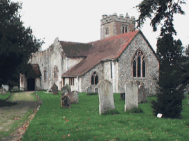
Aldingbourne
is one of the larger parishes in
England, about 6 miles long and 2 miles
wide, and contains Norton, Nyton, part
of Fontwell, Westergate, Woodgate,
Lidsey and Aldingbourne.
Aldingbourne,
mentioned in the Domesday Book, takes
its name from 'Elda' a Saxon Chieftain,
and means Elda's home by the stream; it
is probable that the Rife which runs up
to the back of the Church was originally
navigable for Saxon boats. The
Bishop's Palace stood in a large park
roughly bounded by Nyton Road and
Westergate Street, and included Mill
Pond, which was kept well stocked with
fish for the clergy.
The Palace was destroyed by
Parliamentary Forces in 1642, but
the remaining mound is still visible.
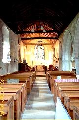
It
is evident that there were quite a few
houses in the vicinity of the Church but
after the Black Death in 1359 the people
moved away to the next stream, the Rife,
which now acts as the boundary between
Eastergate and Westergate.
|