![]()
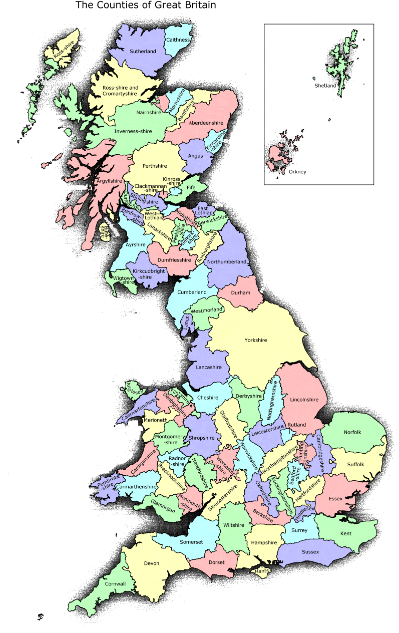
The purpose of this map is to give a reasonably accurate large-scale representation of the 86 Counties of Britain. No claim to small-scale planimetric accuracy is made. For the sake of convenience and practicality only the major (i.e. most sizeable) detached parts are shown (specifically those of Flintshire, Lancashire, Dunbartonshire and Worcestershire). All other detached parts are shown as part of the County in which they locally lie. Due to the fragmentary nature of Cromartyshire, it is shown as a single geographical area with Ross-shire, the combined area being labelled "Ross-shire and Cromartyshire".
The map may be copied and used freely. However, the Association of British Counties would appreciate an acknowledgement and a link to our site.
ABC's Home Page | Meet the Counties | Map | Gazetteer | Postal Directory | FAQ | Links | Join ABC |